
Page 5 - Acoustical_underwater_2003
P. 5
Revue d'Archéométrie, 27, 2003 41
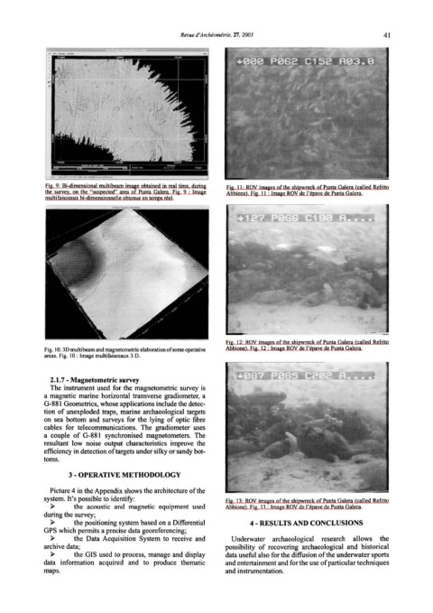
Fig. 9: Bi-dimensionai multibeam image obtained in real time, during Fig. Il: ROV images ofthe shipwreck of Punta Galera (called Relitto
the survey, on the "suspected" area of Punta Galera. Fig. 9 : lmage Abbione). Fig. Il : lmage ROV de l'épave de Punta Galera.
multifaisceaux bi-dimensionnelle obtenue en temps réel.
Fig. 12: ROV images ofthe shipwreck ofPunta Galera (called Relitto
Fig. l 0: 3D multibeam an d magnetometric elaboration of some operative Abbione). Fig. 12: Image ROV de l'épave de Punta Galera.
areas. Fig. l O : lmage multifaisceaux 3 D.
2.1.7- Magnetometric survey
The instrument used for the magnetometric survey is
a magnetic marine horizontal transverse gradiometer, a
G-881 Geometrics, whose applications include the detec-
tion of unexploded traps, marine archaeological targets
on sea bottom and surveys for the lying of optic fibre
cables for telecommunications. The gradiometer uses
a couple of G-881 synchronised magnetometers. The
resultant low noise output characteristics improve the
efficiency in detection oftargets under silky or sandy bot-
toms.
3- OPERATIVE METHODOLOGY
Picture 4 in the Appendi x shows the architecture of the
system. lt's possible to identify: Fig. 13: ROV images of the shipwreck of Punta Galera ( called Relitto
)> the acoustic and magnetic equipment used Ahhione). Fig. 1 ~ : lmage ROV de l'épave de Punta Galera.
during the survey;
)> the positioning system based on a Differential 4- RESULTS AND CONCLUSIONS
GPS which permits a precise data georeferencing;
)> the Data Acquisition System to receive and Underwater archaeological research allows the
archive data; possibility of recovering archaeological and historical
)> the GIS used to process, manage and display data useful al so for the diffusion ofthe underwater sports
data information acquired and to produce thematic and entertainment and for the use of particular techniques
maps. and instrumentation.