
Page 5 - Cocito_alii_2015
P. 5
located on the inner continental shelf between 19 and 50
m depth; they represent very interesting features from
an environmental and geological point of view and also
for the ecology and marine biology of benthos. Seabed
sediments on the continental shelf around Egadi Islands
are mainly constituted by heterogeneous mixtures
composed by pebbles and gravels with medium to
coarse sands, rich in bioclasts [5].
Among natural features of the sea bottom, as already
mentioned, Posidonia oceanica meadows are the
most important biocoenoses for their abundance and
distribution all around the islands. P. oceanica meadows
are one of the most important Mediterranean ecosystems
and represent a high-value habitat for both their
ecological role and the associated biodiversity. Seagrass
beds are a high-productivity ecosystem: they produce
oxygen, represent a reproductive and nursery area for
several species, reduce the energy of the currents and Research & development
waves on the submerged beach, and contribute to the
stability of the sea bottom and beach protection [6, 7].
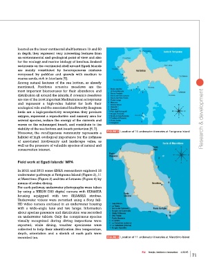
Moreover, the coralligenous community represents a FIGURE 2 Location of 15 underwater itineraries at Favignana Island
habitat of high ecological importance for the richness
of associated biodiversity and landscape value, as
well as the presence of valuable species of natural and
conservation interest.
Field work at Egadi Islands’ MPA
In 2012 and 2013 some ENEA researchers explored 15
underwater pathways at Favignana Island (Figure 2), 11
at Marettimo (Figure 3) and two at Levanzo (Figure 4) by
means of scuba diving.
For each pathway, underwater photographs were taken
by using a NIKON D80 digital camera with SEA&SEA
housing equipped with two SEA&SEA strobes.
Underwater videos were recorded using a Sony full-
HD video camera enclosed in an underwater housing
with a wide-angle lens and two lamps. Information
about species presence and distribution was recorded
on underwater tablets. Only the conspicuous species
visually recognized during diving inspections were
reported; while diving, voucher specimens were
collected to help their identification. Sea temperature,
depth, orientation and a sketch of each path were
recorded too. FIGURE 3 Location of 11 underwater itineraries at Marettimo Island
EAI Energia, Ambiente e Innovazione 4/2015
71