
Page 4 - EAI-4_2015_12_19
P. 4
From an oceanographic point of view, this area presents these include global warming, ocean acidification
a complex water circulation because located between and spreading oceanic ‘dead zones’;
the western and eastern basin of the Mediterranean • the biosphere both on land and in the sea, as a result
Sea. It undergoes, therefore, to water mass mixing of habitat loss, predation, species invasions and the
effects. The range of transition produces significant physical and chemical changes noted above.
changes in the thermohaline structure, with vortices In the present study, manmade features have been
and spots of biodiversity and high productivity. The mapped in the emerged and submerged environment
Egadi archipelago is characterized by deep and surface within the Egadi archipelago, which seems an “open
currents, which can reach high speeds (especially laboratory” for Antropocene studies.
inside the submarine canyon separating the island
of Marettimo from Favignana and Levanzo), whereas Research & development
deployments of current meter SD6000® conducted Data and materials
between September 2000 and January 2001 on the
shoreface of Cala Azzurra at 9 to12 m depth, revealed Several sources of information were consulted
clockwise currents with speed values ranging between and raster and vector available dataset collected,
4,4 and 8,2 cm/s. organised, geo-referenced and re-interpreted. Layers
In stratigraphic and sedimentological terms, we are now inherent to cartography, topography, bathymetry,
living in the Holocene, the geological epoch that began marine biotic communities, geology, hydrogeology, use
12,000 years ago after the Pleistocene. Nevertheless, of soil, vulnerability and the geological risk (landslides
P. Crutzen, Nobel Prize for Chemistry in 1995 for his along stretches of coastline subject to coastal erosion in
studies on the ozone hole in Antarctica, coined the particular), were implemented. The data, provided by
term Antropocene in order to define this last part of the Town Hall and the Egadi Islands’ MPA, integrated
Holocene and identify it as the first geological era, in within the Geological mapping,the PAI and the Regional
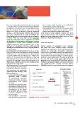
which human activities have been able to influence the Technical Cartography (Figure 1), were georeferenced
natural balance of the Planet. and transformed into a single reference system
The Anthropocene [7], is a term widely used to denote the (WGS84) to obtain a geographically coherent database.
present time interval,in which many
geologically significant conditions
and processes are profoundly
altered by human activities. These
include changes in:
• erosion and sediment transport
associated with a variety
of anthropogenic processes,
including colonisation,agriculture,
urbanisation and global
warming;
• the chemical composition of the
atmosphere, oceans and soils,
with significant anthropogenic
perturbations of the cycles
of elements such as carbon,
nitrogen, phosphorus and
various metals;
• environmental conditions
generatedbytheseperturbations; FIGURE 1 Structure of the Geodatabase
13EAI Energia, Ambiente e Innovazione 4/2015